top of page

FAQs
See below for some of our frequently asked questions. If you have any other questions please reach out!
Short-form commercials are designed to capture attention quickly, whether on TV or online. Austin businesses often use them to highlight their brand during busy times like SXSW or ACL Fest, when the city is buzzing with visitors.
A brand story runs 2–4 minutes and goes deeper into your company’s people, values, and history. Construction companies in East Austin use them to show long-term projects, while tech firms near the Domain use them to showcase culture and innovation.
Our 3-month retainer provides ongoing filming, editing, and delivery so you always have fresh content. Many local shops on South Congress and restaurants in East Austin rely on this steady flow of video to stay visible year-round.
Yes, we produce vertical videos optimized for engagement. These are especially effective for Austin businesses wanting to connect with younger audiences in neighborhoods like Mueller or around the UT campus.
Instead of one-off videos, this package gives you a consistent stream of short-form content for three months. Many Austin startups use it to stay top of mind in competitive spaces like health tech and food service.
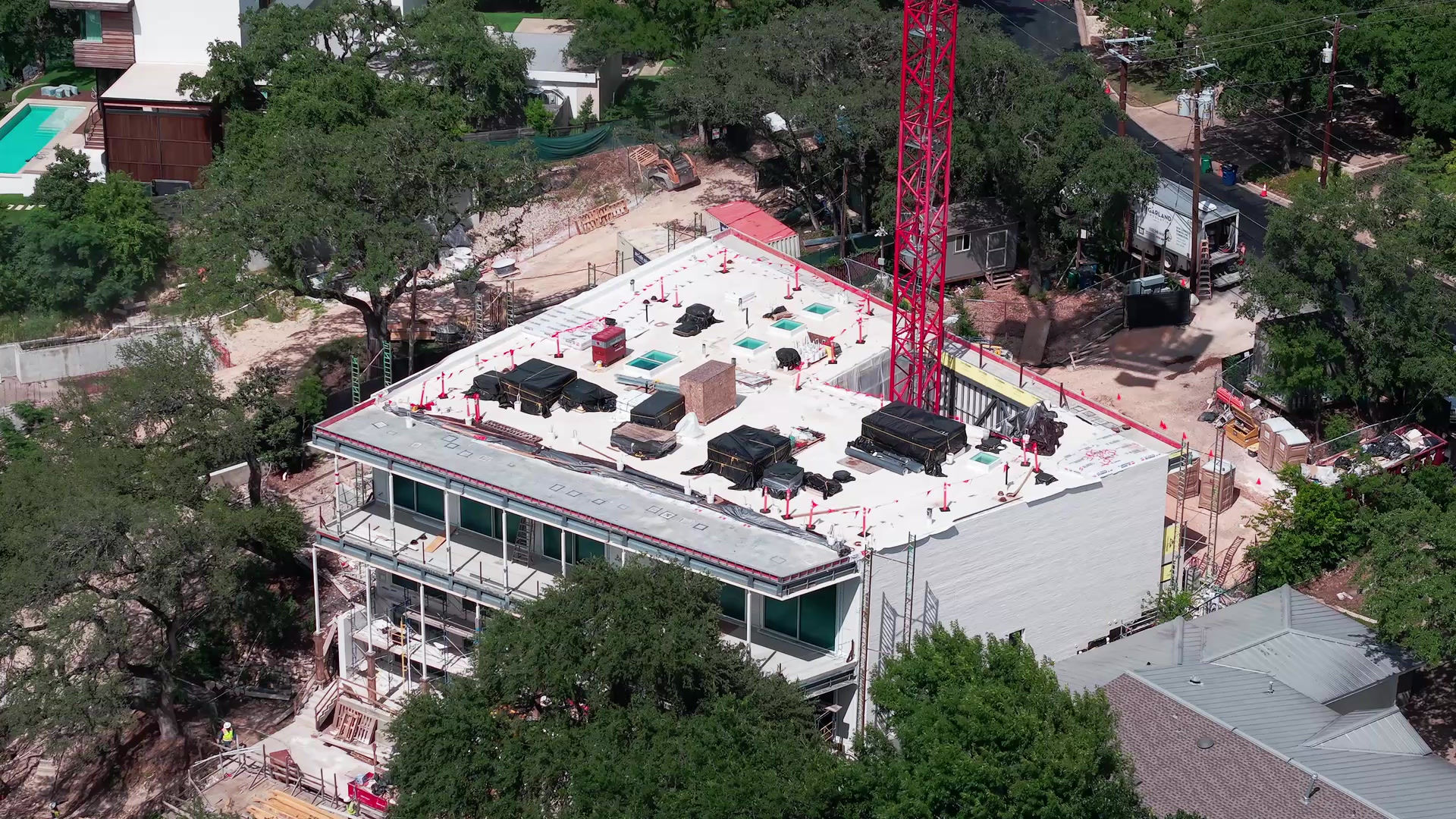
Drones capture top-down photos of your site at key phases. It’s especially useful for large-scale developments along I-35, suburban growth in Pflugerville, and even boutique builds going up in Travis Heights.
A 4K fly-through offers a cinematic perspective that simple photos can’t match. Developers often showcase these videos when pitching investors on new downtown high-rises or industrial parks along Highway 183.
This package combines aerial photography with a 4K video to give a complete view of your site. Builders around Manor and Del Valle often use it for both documentation and marketing.
It’s a digital scan of interior spaces, typically done during pre-drywall or rough-in phases. This record helps contractors in places like Westlake or Lakeway track progress and avoid future issues hidden behind finished walls.
Drone photogrammetry creates accurate 3D site models for planning and visualization. Large commercial projects near the airport and mixed-use builds in Mueller benefit from these models for both design and investor presentations.
We handle towers, pipelines, and utility infrastructure without scaffolding or shutdowns. This has been especially useful for utility upgrades in fast-growing areas north of Round Rock.
Our drones document erosion, drainage, and vegetation changes with precision. This service is often used on projects near Lady Bird Lake or along Barton Creek to ensure compliance with environmental requirements.
Absolutely, we provide clear visuals for roof conditions, storm damage, and overall property health. Realtors in neighborhoods like Tarrytown and Hyde Park frequently use this service to market listings.
A building inspection focuses on structural features such as roofs, facades, and HVAC systems. A property inspection looks at land and site conditions. Together, they give a full picture — whether it’s a warehouse near South Congress or an office park in North Austin.
Drones monitor crops, irrigation, and soil conditions. Central Texas farms out by Driftwood and Bastrop use them to improve yields and cut down on labor costs.
Drones are faster, safer, and more cost-effective. For example, inspecting a warehouse roof in South Austin no longer requires scaffolding or lifts — just a 20-minute drone flight.
Many builders schedule flights weekly or monthly to create a visual timeline. This is especially helpful for long-term projects like subdivisions in Kyle or new office space near the Capitol.
Yes — high-resolution drone documentation supports permitting and inspection processes. Builders in East Riverside and North Austin developments often use it to stay ahead of city requirements.
We do. Many clients request same-day flights to capture weather-sensitive conditions or before a milestone like topping out a high-rise in downtown Austin.
Yes, every pilot is FAA Part 107 certified, and we carry full liability insurance. That way, whether you’re documenting a home in Round Rock or a factory build in Buda, your project is fully protected.
bottom of page